
The Santa Fe River
The Santa Fe River is 72 miles long, flowing west from Lake Santa Fe in eastern Alachua County to the Suwannee River.
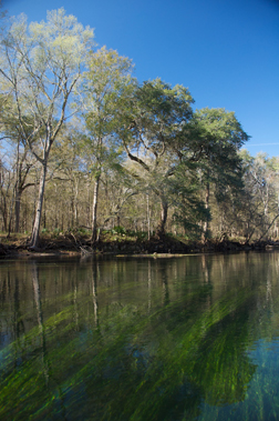
The upper Santa Fe is a dark water river. Beneath the surface soils lies an impenetrable layer of clay. Rainfall here collects on the surface and drains to the river and its bottom lands. Decaying vegetation in these bottom lands add tannins, staining the water the color of tea.
At the River Sink, the entire Santa Fe River goes underground for three miles. It returns to the surface at the River Rise. Here the geology and the character of the river begin to change.
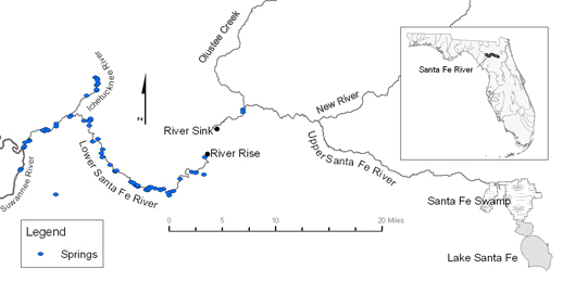
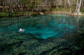
The lower Santa Fe flows through a dry plain with no confining layer of clay. The rainwater sinks into the sandy soil and the underlying limestone. The slightly acidic rainwater dissolves the limestone, and over thousands of years has caused the formation of caves, springs, swallets and rises.
There are more than 75 springs along the lower Santa Fe. Water moves through the underground limestone aquifer, discharging as springs that feed the river. In periods of low rainfall, the flow from the upper Santa Fe diminishes and the lower Santa Fe is fed predominantly by the springs and runs clear.
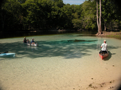
Ginnie Spring Rum Island Spring
© 2013 All Rights Reserved